
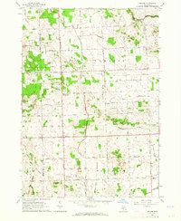
1963 Map of Shabbona
USGS Topo · Published 1964About this map
Shabbona and the surrounding farmland of Sanilac and Tuscola Counties are documented here during the early 1960s. The landscape is defined by the winding course of the South Branch Cass River, which is fed by numerous agricultural drains and small waterways like Greenman Creek and Stony Creek. This rural interior is characterized by a grid of section-line roads, such as Argyle Road and Deckerville Road, connecting small community centers and rural institutions.
Find a feature on this map
58 named features on this map. Tap any name to fly to it.
Don’t see what you’re looking for? This feature index may not catch every label — zoom into the map to look around manually.
Map Details
Editions of this 1963 Shabbona Map
This is the sole edition of this map. No revisions or reprints were ever made.
Other maps of this area

1954 · Flint
USGS Topo · 1:250,000

1958 · Flint
USGS Topo · 1:250,000

1963 · Snover
USGS Topo · 1:24,000

1963 · New Greenleaf
USGS Topo · 1:24,000

1963 · Ubly
USGS Topo · 1:24,000

1963 · Kingston
USGS Topo · 1:24,000

1963 · Cass City
USGS Topo · 1:24,000

1963 · Gagetown
USGS Topo · 1:24,000
1963 · Decker
USGS Topo · 1:24,000

1963 · Argyle
USGS Topo · 1:24,000