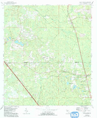
1955 Map of Shady Grove
USGS Topo · Published 1993About this map
The Econfina River and its many tributaries, such as Alligator Creek, define the wet, low-lying borderlands where the Madison Co Taylor Co line is drawn. This survey provides a detailed record of small, localized communities that once dotted the North Florida landscape, including Shady Grove, Eridu, Iddo, and Ebb. The distribution of rural life is marked by numerous country sanctuaries and resting places, such as Fellowship Ch and the Pleasant Grove Cem.
Find a feature on this map
20 named features on this map. Tap any name to fly to it.
Don’t see what you’re looking for? This feature index may not catch every label — zoom into the map to look around manually.
Map Details
Editions of this 1955 Shady Grove Map
4 editions found
Other maps of this area

1952 · Secotan
USGS Topo · 1:24,000

1954 · Johnson Hammock
USGS Topo · 1:24,000

1954 · Boyd
USGS Topo · 1:24,000

1954 · Secotan
USGS Topo · 1:24,000

1954 · Greenville
USGS Topo · 1:24,000

1954 · Greenville NE
USGS Topo · 1:24,000

1954 · Valdosta
USGS Topo · 1:250,000

1955 · Lamont
USGS Topo · 1:24,000

1955 · Shady Grove
USGS Topo · 1:24,000

1955 · Lamont SE
USGS Topo · 1:24,000