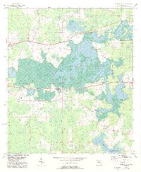
1954 Map of Greenville NE
USGS Topo · Published 1993About this map
Hixtown Swamp dominates this landscape, its intricate network of wetlands and islands defining the local geography. To the west, the settlement of Greenville marks the edge of this vast watery expanse, while rural life is anchored by institutions such as Concord Ch and Evergreen Cem. The map reveals a community deeply tied to the natural water systems, with Sundown Creek and the shores of Indian Lake providing essential landmarks for the area's early residents.
Find a feature on this map
13 named features on this map. Tap any name to fly to it.
Don’t see what you’re looking for? This feature index may not catch every label — zoom into the map to look around manually.
Map Details
Editions of this 1954 Greenville NE Map
2 editions found
Other maps of this area

1954 · Greenville
USGS Topo · 1:24,000

1954 · Greenville NE
USGS Topo · 1:24,000

1954 · Valdosta
USGS Topo · 1:250,000

1955 · Shady Grove
USGS Topo · 1:24,000

1955 · Greenville SE
USGS Topo · 1:24,000

1958 · Valdosta
USGS Topo · 1:250,000

1958 · Madison SW
USGS Topo · 1:24,000

1959 · Valdosta
USGS Topo · 1:250,000

1959 · Madison
USGS Topo · 1:24,000

1960 · Cherry Lake
USGS Topo · 1:24,000