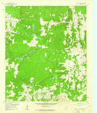
1960 Map of Shady Grove
USGS Topo · Published 1961About this map
Hawkins Oil Field occupies the southern reaches of this landscape, its presence defined by the networks of roads and drilling sites situated just above the Wood Co Upshur Co line. The terrain is deeply carved by the Big Sandy Creek system, creating a dense pattern of ridges and bottomlands where small settlements like Shady Grove are established. This 1960 field check reveals a community anchored by its rural institutions, including Little Mound Missionary Ch and Maple Springs Ch.
Find a feature on this map
30 named features on this map. Tap any name to fly to it.
Don’t see what you’re looking for? This feature index may not catch every label — zoom into the map to look around manually.
Map Details
Editions of this 1960 Shady Grove Map
Other maps of this area

1956 · Tyler
USGS Topo · 1:250,000

1960 · Shady Grove
USGS Topo · 1:24,000

1960 · Hawkins
USGS Topo · 1:24,000

1960 · Big Sandy
USGS Topo · 1:24,000

1960 · Pritchett
USGS Topo · 1:24,000

1960 · Hainesville
USGS Topo · 1:24,000

1960 · Cartwright
USGS Topo · 1:24,000

1960 · Thomas
USGS Topo · 1:24,000

1960 · Rhonesboro
USGS Topo · 1:24,000

1960 · Crow
USGS Topo · 1:24,000