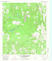
1960 Map of Shady Grove
USGS Topo · Published 1982About this map
Hawkins Oil Field dominates the southern landscape of this Wood County quadrangle, where the industrial infrastructure of energy extraction meets a complex network of East Texas waterways. The area is defined by the winding paths of Big Sandy Creek and Glade Creek, supporting a series of small water bodies including Holly Lake, Brooks Lake, and the larger Lake Hawkins. The settlement of Shady Grove sits near the eastern boundary, while the interior features local landmarks such as Brookhaven Lodge and the expansive Warren Swamp.
Find a feature on this map
37 named features on this map. Tap any name to fly to it.
Don’t see what you’re looking for? This feature index may not catch every label — zoom into the map to look around manually.
Map Details
Editions of this 1960 Shady Grove Map
Other maps of this area

1956 · Tyler
USGS Topo · 1:250,000

1960 · Shady Grove
USGS Topo · 1:24,000

1960 · Hawkins
USGS Topo · 1:24,000

1960 · Big Sandy
USGS Topo · 1:24,000

1960 · Pritchett
USGS Topo · 1:24,000

1960 · Hainesville
USGS Topo · 1:24,000

1960 · Cartwright
USGS Topo · 1:24,000

1960 · Thomas
USGS Topo · 1:24,000

1960 · Rhonesboro
USGS Topo · 1:24,000

1960 · Crow
USGS Topo · 1:24,000