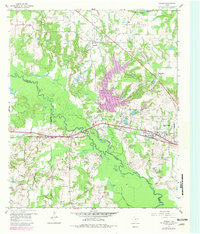
1959 Map of Golden
USGS Topo · Published 1981About this map
The Sabine River meanders across this East Texas landscape, forming the natural boundary where Wood, Van Zandt, and Smith counties converge. In the late 1950s, the area's geography was defined by a complex network of bottomland lakes and creeks, including Silver Lake, Butler Lake, and Clear Lake, which sit amidst the river's winding path. The northern portion of the map centers on the community of Golden, while the southern reaches show the expansion of Mineola and West Mineola along the Texas and Pacific Railroad.
Find a feature on this map
44 named features on this map. Tap any name to fly to it.
Don’t see what you’re looking for? This feature index may not catch every label — zoom into the map to look around manually.
Map Details
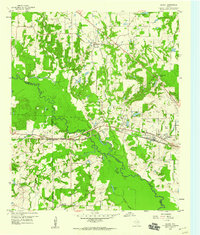
Editions of this 1959 Golden Map
Other maps of this area

1956 · Tyler
USGS Topo · 1:250,000

1958 · Alba
USGS Topo · 1:24,000

1959 · Calvary
USGS Topo · 1:24,000

1959 · Golden
USGS Topo · 1:24,000

1959 · Grand Saline
USGS Topo · 1:24,000

1959 · Van
USGS Topo · 1:24,000

1959 · Van Lake
USGS Topo · 1:24,000

1959 · Grand Saline
USGS Topo · 1:62,500

1959 · Alba
USGS Topo · 1:62,500

1960 · Lindale
USGS Topo · 1:24,000