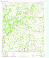
1960 Map of Pleasant Grove
USGS Topo · Published 1980About this map
Coke Oil Field and Manziel Oil Field dominate the center of this Wood County landscape, revealing an era of intense petroleum extraction during the mid-20th century. The transition from agricultural use to an industrial energy economy is marked by numerous oil and gas wells, a Pumping Station, and several sludge pits scattered across the terrain. Small rural communities like Coke, Pleasant Grove, and Black Oak serve as focal points for local history, often centered around institutions such as Rock Hill Church and its adjacent Rock Hill Cemetery. Water features including Honey Creek, Dry Creek, and the northern reaches of Lake Quitman provide the natural structure for the region's topography. Notable for genealogists, the map preserves the location of many isolated homesteads and field lines, alongside smaller settlements like Brier and the southern edge of Pickton near the northern county line.
Find a feature on this map
23 named features on this map. Tap any name to fly to it.
Don’t see what you’re looking for? This feature index may not catch every label — zoom into the map to look around manually.
Map Details
Editions of this 1960 Pleasant Grove Map
2 editions found
Other maps of this area

1953 · Texarkana
USGS Topo · 1:250,000

1956 · Texarkana
USGS Topo · 1:250,000

1956 · Tyler
USGS Topo · 1:250,000

1959 · Calvary
USGS Topo · 1:24,000

1959 · Yantis
USGS Topo · 1:24,000

1959 · Alba
USGS Topo · 1:62,500

1960 · Winnsboro
USGS Topo · 1:24,000

1960 · Cartwright
USGS Topo · 1:24,000

1960 · Pleasant Grove
USGS Topo · 1:24,000

1960 · Quitman
USGS Topo · 1:24,000