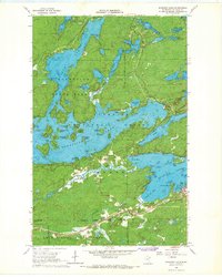
1965 Map of Shagawa Lake
USGS Topo · Published 1967About this map
Ely sits at the edge of a massive aquatic network in the mid-1960s, serving as a gateway to the Superior National Forest and surrounding state timberlands. The landscape is defined by the deep indentations of Burnt Side Lake, where dozens of named landforms like Waters Island and Honeymoon Island break the water's surface. This era captures the region's industrial backbone through the Duluth Missabe and Iron Range railroad, which skirts the southern shore of Shagawa Lake.
Find a feature on this map
65 named features on this map. Tap any name to fly to it.
Don’t see what you’re looking for? This feature index may not catch every label — zoom into the map to look around manually.
Map Details
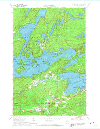
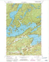
Editions of this 1965 Shagawa Lake Map
3 editions found
Other maps of this area

1933 · Ely
USGS Topo · 1:62,500

1939 · Ely
USGS Topo · 1:62,500

1954 · Two Harbors
USGS Topo · 1:250,000

1954 · Hibbing
USGS Topo · 1:250,000

1954 · International Falls
USGS Topo · 1:250,000

1956 · Crab Lake
USGS Topo · 1:24,000

1956 · Eagles Nest
USGS Topo · 1:24,000

1957 · Two Harbors
USGS Topo · 1:250,000

1957 · Hibbing
USGS Topo · 1:250,000

1957 · International Falls
USGS Topo · 1:250,000