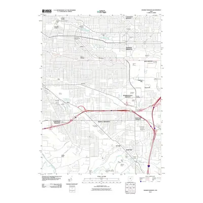
2010 Map of Shaker Heights
USGS Topo · Published 2010About this map
University Heights and Shaker Heights anchor the northern half of this topographic study, where the planned residential grid is punctuated by the waters of Upper Shaker Lake and Lower Shaker Lake along Doan Brook. To the east, the sprawling campus of John Carroll University and the University School sit near Lyman Circle, reflecting the educational and social character of these established suburbs. The landscape shifts south toward a high density of memorial grounds, including Highland Park Cemetery and Zion Memorial Park Cemetery, illustrating the long-term land-use patterns of eastern Cuyahoga County.
Find a feature on this map
86 named features on this map. Tap any name to fly to it.
Don’t see what you’re looking for? This feature index may not catch every label — zoom into the map to look around manually.
Map Details
Editions of this 2010 Shaker Heights Map
This is the sole edition of this map. No revisions or reprints were ever made.
Other maps of this area

1901 · Euclid
USGS Topo · 1:62,500

1903 · Cleveland
USGS Topo · 1:62,500

1903 · Euclid
USGS Topo · 1:62,500

1905 · Mentor
USGS Topo · 1:62,500

1906 · Chagrin Falls
USGS Topo · 1:62,500

1907 · Mentor
USGS Topo · 1:62,500

1908 · Chagrin Falls
USGS Topo · 1:62,500

1950 · Cleveland
USGS Topo · 1:250,000

1953 · Chagrin Falls
USGS Topo · 1:24,000

1953 · Shaker Heights
USGS Topo · 1:24,000