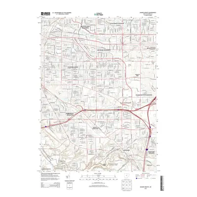
2013 Map of Shaker Heights
USGS Topo · Published 2013About this map
Cuyahoga Valley National Park and the dense suburban corridors of eastern Greater Cleveland define this 2013 survey. The landscape is characterized by its organized residential expansion and preserved green spaces, most notably the Shaker Lakes system, which includes Upper Shaker Lake and Lower Shaker Lake along Doan Brook. Major institutional landmarks like John Carroll Univ in University Heights anchor the northern section, while the southern reaches follow the rugged topography of Tinkers Creek.
Find a feature on this map
66 named features on this map. Tap any name to fly to it.
Don’t see what you’re looking for? This feature index may not catch every label — zoom into the map to look around manually.
Map Details
Editions of this 2013 Shaker Heights Map
This is the sole edition of this map. No revisions or reprints were ever made.
Other maps of this area

1901 · Euclid
USGS Topo · 1:62,500

1903 · Cleveland
USGS Topo · 1:62,500

1903 · Euclid
USGS Topo · 1:62,500

1905 · Mentor
USGS Topo · 1:62,500

1906 · Chagrin Falls
USGS Topo · 1:62,500

1907 · Mentor
USGS Topo · 1:62,500

1908 · Chagrin Falls
USGS Topo · 1:62,500

1950 · Cleveland
USGS Topo · 1:250,000

1953 · Chagrin Falls
USGS Topo · 1:24,000

1953 · Shaker Heights
USGS Topo · 1:24,000