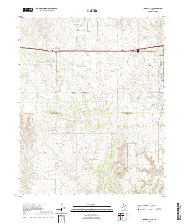
2022 Map of Shamrock West
USGS Topo · Published 2022About this map
Shamrock sits at the eastern edge of this Panhandle landscape, where the town's residential streets like N Wall St and W 5th St transition into the open ranching and agricultural terrain of Wheeler Co and Collingsworth Co. The corridor is defined by the heavy transit route of the I-40 Service Road, which connects the larger hub of Shamrock to the smaller settlement of Lela.
Find a feature on this map
43 named features on this map. Tap any name to fly to it.
Don’t see what you’re looking for? This feature index may not catch every label — zoom into the map to look around manually.
Map Details
Editions of this 2022 Shamrock West Map
This is the sole edition of this map. No revisions or reprints were ever made.
Other maps of this area

1954 · Amarillo
USGS Topo · 1:250,000

1958 · Amarillo
USGS Topo · 1:250,000

1962 · Twitty
USGS Topo · 1:24,000

1962 · Wheeler SE
USGS Topo · 1:24,000

1962 · Pakan
USGS Topo · 1:24,000

1963 · Ramsdell
USGS Topo · 1:24,000

1963 · Shamrock East
USGS Topo · 1:24,000

1963 · Shamrock West
USGS Topo · 1:24,000
1964 · Abra
USGS Topo · 1:24,000
1964 · Dozier
USGS Topo · 1:24,000