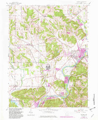
1965 Map of Shandon
USGS Topo · Published 1982About this map
The Great Miami River and the Whitewater River define the lower reach of this landscape along the Butler and Hamilton county line. The area is characterized by a network of established family settlements and small crossroads communities, including Ross, Shandon, and New Baltimore. A significant industrial and security presence is marked at the U S Reservation Department of Energy near Fernald, situated between Paddys Run and the river.
Find a feature on this map
46 named features on this map. Tap any name to fly to it.
Don’t see what you’re looking for? This feature index may not catch every label — zoom into the map to look around manually.
Map Details
Editions of this 1965 Shandon Map
3 editions found
Other maps of this area

1914 · West Cincinnati
USGS Topo · 1:62,500

1915 · Lawrenceburg
USGS Topo · 1:48,000

1915 · Harrison
USGS Topo · 1:48,000

1915 · Hamilton
USGS Topo · 1:62,500

1917 · Hamilton
USGS Topo · 1:62,500

1928 · Lawrenceburg
USGS Topo · 1:62,500

1932 · Lawrenceburg
USGS Topo · 1:62,500

1943 · Hooven
USGS Topo · 1:24,000

1953 · Cincinnati West
USGS Topo · 1:24,000

1953 · Cincinnati
USGS Topo · 1:250,000