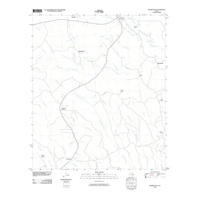
2010 Map of Shankleville
USGS Topo · Published 2010About this map
Shankleville and its surrounding timberlands in Newton County are documented here in 2010, showing the persistent network of rural communities that define this corner of East Texas. The landscape is structured by a dense web of creeks and bayous, including the winding course of Yellow Bayou and the headwaters of Little Quicksand Creek. In this era, the region maintains its historic settlement patterns, with small community centers like Wiergate and Burkeville connected by Farm to Market roads such as FM 1415. Local heritage is anchored by sites like Simmons Cemetery and Saint Johns Cemetery, which serve as physical links to the families who established these namesake settlements. The inclusion of the Burkeville Lookout Tower and Newton Municipal Airport reflects the dual priorities of forest management and regional connectivity in this pine-heavy terrain.
Find a feature on this map
38 named features on this map. Tap any name to fly to it.
Don’t see what you’re looking for? This feature index may not catch every label — zoom into the map to look around manually.
Map Details
Editions of this 2010 Shankleville Map
This is the sole edition of this map. No revisions or reprints were ever made.
Other maps of this area

1944 · Wiergate
USGS Topo · 1:62,500

1946 · Merryville
USGS Topo · 1:31,680

1948 · Wiergate
USGS Topo · 1:62,500

1949 · Evans
USGS Topo · 1:31,680

1952 · Lake Charles
USGS Topo · 1:250,000

1953 · Alexandria
USGS Topo · 1:250,000
1954 · Merryville
USGS Topo · 1:31,680

1954 · Wiergate
USGS Topo · 1:24,000

1954 · Wiergate SE
USGS Topo · 1:24,000

1954 · Wiergate
USGS Topo · 1:62,500