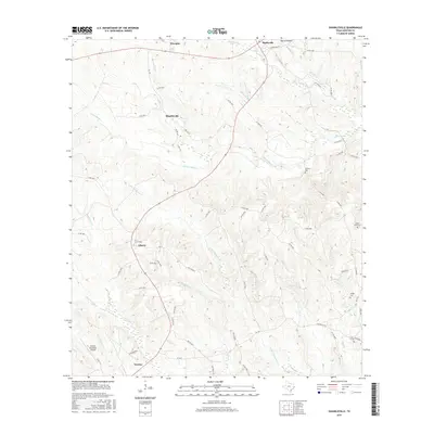
2016 Map of Shankleville
USGS Topo · Published 2016About this map
Shankleville and the surrounding piney woods of East Texas are documented in this 2016 survey, showcasing a landscape defined by historically significant settlements and a dense network of tributaries. The map covers the area from Wiergate and Burkeville in the north down to the city of Newton and the Newton Municipal Airport in the south. Genealogists will find particular value in the placement of several family-linked burial grounds, including Simmons Cem, Saint Johns Cem, and Griggs Cem. The terrain is etched by numerous watercourses such as Yellow Bayou, Little Quicksand Cr, and Richland Br, which dictate the winding paths of county roads like Co Rd 1041 and Co Rd 2060. The map illustrates the persistent footprint of small communities like Liberty and the rural infrastructure that connects these historic Texas townships.
Find a feature on this map
63 named features on this map. Tap any name to fly to it.
Don’t see what you’re looking for? This feature index may not catch every label — zoom into the map to look around manually.
Map Details
Editions of this 2016 Shankleville Map
This is the sole edition of this map. No revisions or reprints were ever made.
Other maps of this area

1944 · Wiergate
USGS Topo · 1:62,500

1946 · Merryville
USGS Topo · 1:31,680

1948 · Wiergate
USGS Topo · 1:62,500

1949 · Evans
USGS Topo · 1:31,680

1952 · Lake Charles
USGS Topo · 1:250,000

1953 · Alexandria
USGS Topo · 1:250,000
1954 · Merryville
USGS Topo · 1:31,680

1954 · Wiergate
USGS Topo · 1:24,000

1954 · Wiergate SE
USGS Topo · 1:24,000

1954 · Wiergate
USGS Topo · 1:62,500