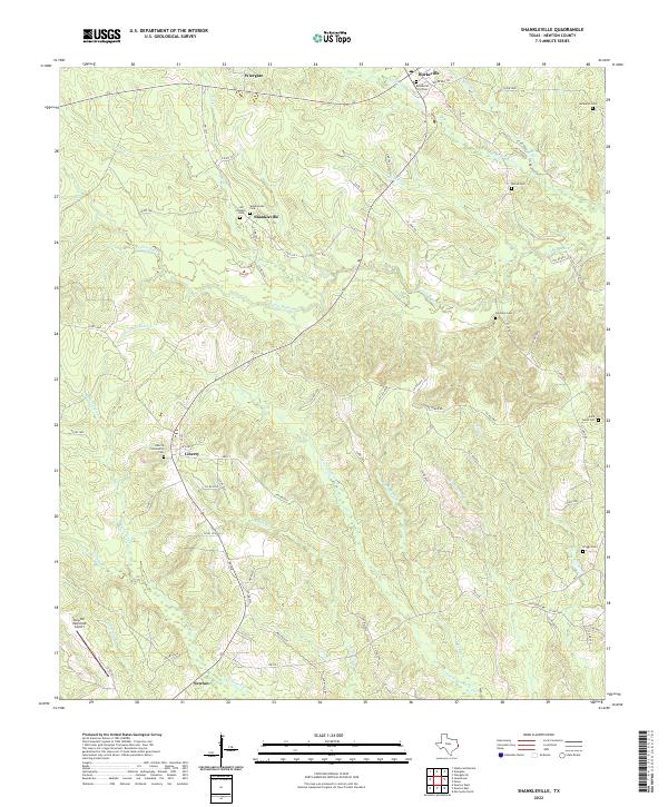
2022 Map of Shankleville
USGS Topo · Published 2022About this map
Shankleville and its neighboring settlements define this pocket of Newton County, where family-named landmarks provide a window into the area's rural heritage. This landscape is marked by several significant burial grounds, including the Jim Shankle Cem and Shankleville Cem, which anchor the local history of the freedom colony established here. To the north, the communities of Wiergate and Burkeville sit along the upper reaches of Little Cow Cr, while Newton occupies the southwestern corner of the sheet near the Newton Municipal Airport.
Find a feature on this map
76 named features on this map. Tap any name to fly to it.
Don’t see what you’re looking for? This feature index may not catch every label — zoom into the map to look around manually.
Map Details
Editions of this 2022 Shankleville Map
This is the sole edition of this map. No revisions or reprints were ever made.
Other maps of this area

1944 · Wiergate
USGS Topo · 1:62,500

1946 · Merryville
USGS Topo · 1:31,680

1948 · Wiergate
USGS Topo · 1:62,500

1949 · Evans
USGS Topo · 1:31,680

1952 · Lake Charles
USGS Topo · 1:250,000

1953 · Alexandria
USGS Topo · 1:250,000
1954 · Merryville
USGS Topo · 1:31,680

1954 · Wiergate
USGS Topo · 1:24,000

1954 · Wiergate SE
USGS Topo · 1:24,000

1954 · Wiergate
USGS Topo · 1:62,500