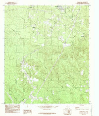
1984 Map of Shankleville
USGS Topo · Published 1985About this map
Shankleville and Wiergate anchor this East Texas landscape, recorded during the late 1970s and early 1980s. The area is defined by a dense network of watercourses, including Little Cow Creek and Yellow Bayou, which carve through the wooded terrain of Newton County. Settlement patterns follow the ridge lines and creek valleys, with smaller communities like Simmonsville and Liberty connected by narrow backroads.
Find a feature on this map
23 named features on this map. Tap any name to fly to it.
Don’t see what you’re looking for? This feature index may not catch every label — zoom into the map to look around manually.
Map Details
Editions of this 1984 Shankleville Map
This is the sole edition of this map. No revisions or reprints were ever made.
Other maps of this area

1944 · Wiergate
USGS Topo · 1:62,500

1946 · Merryville
USGS Topo · 1:31,680

1948 · Wiergate
USGS Topo · 1:62,500

1949 · Evans
USGS Topo · 1:31,680

1952 · Lake Charles
USGS Topo · 1:250,000

1953 · Alexandria
USGS Topo · 1:250,000
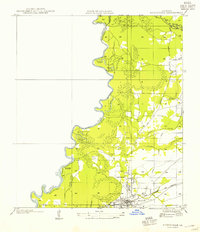
1954 · Merryville
USGS Topo · 1:31,680

1954 · Wiergate
USGS Topo · 1:24,000

1954 · Wiergate SE
USGS Topo · 1:24,000

1954 · Wiergate
USGS Topo · 1:62,500