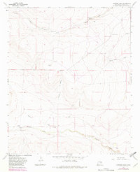
1967 Map of Shannon Draw
USGS Topo · Published 1982About this map
Fivemile Ranch and its surrounding pastoral landscape are the central focus of this Chaves County survey, which documents the remote ranching infrastructure of New Mexico in the late 1960s. The terrain is defined by a network of seasonal watercourses and drainage basins, including Shannon Draw, Fivemile Draw, and the winding Huggins Draw. For local historians and genealogists, the map provides a detailed record of the essential water sources that sustained these isolated operations, from named windmills like Castel Windmill to specific clusters like McDermott Wells.
Find a feature on this map
25 named features on this map. Tap any name to fly to it.
Don’t see what you’re looking for? This feature index may not catch every label — zoom into the map to look around manually.
Map Details
Editions of this 1967 Shannon Draw Map
2 editions found
Other maps of this area

1955 · Roswell
USGS Topo · 1:250,000

1958 · Roswell
USGS Topo · 1:250,000

1962 · Roswell
USGS Topo · 1:250,000

1962 · Eightmile Draw
USGS Topo · 1:24,000

1962 · Marley Draw
USGS Topo · 1:24,000

1963 · Coyote Draw
USGS Topo · 1:24,000

1967 · Deering Place
USGS Topo · 1:24,000

1967 · Cottonwood Draw
USGS Topo · 1:24,000

1967 · Dunlap Sill
USGS Topo · 1:24,000

1967 · Swallow Nest Canyon
USGS Topo · 1:24,000