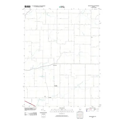
2010 Map of Shannondale
USGS Topo · Published 2010About this map
Shannondale and the surrounding agricultural landscape are defined by a complex network of waterways and drainage systems. The terrain is characterized by the winding paths of Little Sugar Creek and Walnut Fork Sugar Creek, while an extensive system of engineered channels like Gray Ditch, Bodher Ditch, and Needham Ditch reveals the region's long-standing focus on land reclamation for farming. Small rural clusters like Log Cabin Crossroads and Beckville anchor the township, connected by a rigid grid of county roads. Local history and genealogy are preserved at the Pisgah Cemetery and Cox Cemetery, while Pennington Lake provides a rare contained water feature amidst the prevailing creeks and drainage ditches that feed toward Hazel Creek and Dixon Creek.
Find a feature on this map
39 named features on this map. Tap any name to fly to it.
Don’t see what you’re looking for? This feature index may not catch every label — zoom into the map to look around manually.
Map Details
Editions of this 2010 Shannondale Map
This is the sole edition of this map. No revisions or reprints were ever made.
Other maps of this area

1953 · Lizton
USGS Topo · 1:24,000

1953 · Danville
USGS Topo · 1:250,000

1953 · Indianapolis
USGS Topo · 1:250,000

1955 · Danville
USGS Topo · 1:250,000

1956 · Danville
USGS Topo · 1:250,000

1956 · Indianapolis
USGS Topo · 1:250,000

1957 · Indianapolis
USGS Topo · 1:250,000

1957 · New Ross
USGS Topo · 1:24,000

1958 · Darlington
USGS Topo · 1:24,000

1958 · Ladoga
USGS Topo · 1:24,000