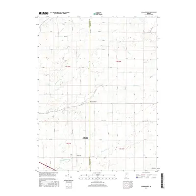
2016 Map of Shannondale
USGS Topo · Published 2016About this map
Shannondale sits at the intersection of several rural roads along the boundary between Montgomery and Boone counties, serving as a quiet focal point in a landscape defined by agricultural drainage and creek systems. To the south, the small settlements of Beckville and Log Cabin Crossroads mark historical pockets of community within the township grid. The terrain is deeply influenced by water management, with numerous named waterways like Needham Booher Ditch and Gray Ditch augmenting natural flows like Little Sugar Creek and Walnut Fork Sugar Creek. For those tracing local family histories, the inclusion of Pisgah Cem and Cox Cem provides specific points of interest. The map illustrates a highly organized section-line road network that reflects the enduring structure of Indiana's rural development and land use into the twenty-first century.
Find a feature on this map
72 named features on this map. Tap any name to fly to it.
Don’t see what you’re looking for? This feature index may not catch every label — zoom into the map to look around manually.
Map Details
Editions of this 2016 Shannondale Map
This is the sole edition of this map. No revisions or reprints were ever made.
Other maps of this area

1953 · Lizton
USGS Topo · 1:24,000

1953 · Danville
USGS Topo · 1:250,000

1953 · Indianapolis
USGS Topo · 1:250,000

1955 · Danville
USGS Topo · 1:250,000

1956 · Danville
USGS Topo · 1:250,000

1956 · Indianapolis
USGS Topo · 1:250,000

1957 · Indianapolis
USGS Topo · 1:250,000

1957 · New Ross
USGS Topo · 1:24,000

1958 · Darlington
USGS Topo · 1:24,000

1958 · Ladoga
USGS Topo · 1:24,000