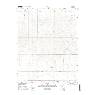
2015 Map of Sharon North
USGS Topo · Published 2015About this map
Sharon anchors the southern edge of this Barber County landscape, where the agricultural grid meets the drainage systems of Little Sandy Cr and Spring Cr. The region is defined by its rural road network, with routes like Plum Thicket Rd, Lone Tree Rd, and Cedar Hills Rd connecting scattered homesteads across the townships. Local history is preserved in several small burial grounds, including the Mumford Cem and Burgess Cem in the north, and the Saint Boniface Cem near the town site. This 2015 survey illustrates a modern view of the Public Land Survey System, showing the persistent division of sections such as T31S R10W and T32S R11W that have dictated Kansas land use for over a century.
Find a feature on this map
26 named features on this map. Tap any name to fly to it.
Don’t see what you’re looking for? This feature index may not catch every label — zoom into the map to look around manually.
Map Details
Editions of this 2015 Sharon North Map
This is the sole edition of this map. No revisions or reprints were ever made.
Other maps of this area

1889 · Anthony
USGS Topo · 1:125,000

1891 · Medicine Lodge
USGS Topo · 1:125,000

1891 · Anthony
USGS Topo · 1:125,000

1893 · Medicine Lodge
USGS Topo · 1:125,000

1955 · Pratt
USGS Topo · 1:250,000

1959 · Pratt
USGS Topo · 1:250,000

1972 · Sharon South
USGS Topo · 1:24,000

1972 · Crisfield
USGS Topo · 1:24,000
1973 · Isabel
USGS Topo · 1:24,000
1973 · Gerlane
USGS Topo · 1:24,000