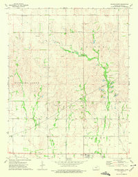
1973 Map of Sharon North
USGS Topo · Published 1975About this map
The town of Sharon anchors the southern portion of this Barber County landscape, situated along the A T & S F railroad line. The map illustrates a region defined by its hydrography and subterranean resources, where the Medicine Lodge River and its tributaries, including Little Sandy Creek and the East Branch Little Sandy Creek, carve through the terrain. A notable network of Pipelines and an extensive Oil and Gas Field reflect the mid-century industrial activity of the area, punctuated by numerous Gas Wells and Oil Wells. For genealogists, the map preserves the locations of several community landmarks, such as Mumford Cem, Burgess Cem, and the St Boniface Cem site, providing exact placement of these historical markers within the rural grid of Kansas.
Find a feature on this map
21 named features on this map. Tap any name to fly to it.
Don’t see what you’re looking for? This feature index may not catch every label — zoom into the map to look around manually.
Map Details
Editions of this 1973 Sharon North Map
This is the sole edition of this map. No revisions or reprints were ever made.
Other maps of this area

1889 · Anthony
USGS Topo · 1:125,000

1891 · Medicine Lodge
USGS Topo · 1:125,000

1891 · Anthony
USGS Topo · 1:125,000

1893 · Medicine Lodge
USGS Topo · 1:125,000

1955 · Pratt
USGS Topo · 1:250,000

1959 · Pratt
USGS Topo · 1:250,000

1972 · Sharon South
USGS Topo · 1:24,000

1972 · Crisfield
USGS Topo · 1:24,000
1973 · Isabel
USGS Topo · 1:24,000
1973 · Gerlane
USGS Topo · 1:24,000