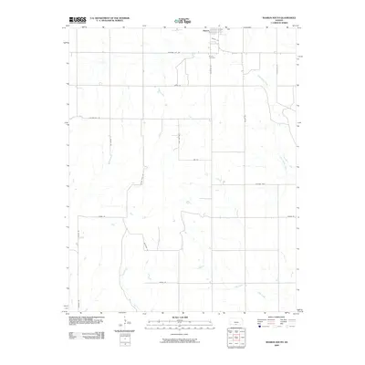
2009 Map of Sharon South
USGS Topo · Published 2009About this map
Sharon anchors the northern edge of this Kansas landscape, serving as a focal point for the surrounding rural network in Barber County. The town is situated just above Sharon Cemetery, with residential streets like Redbird Ave defining its local footprint. The terrain is characterized by the branching drainage of Little Sandy Creek in the northeast and Salty Creek in the southeast, while the grid of section-line roads reveals the enduring agricultural organization of the Great Plains. Distinctive local names like Crooked Post, Lone Tree Rd, and Sandplum Rd suggest a landscape where individual landmarks and botanical features provided essential orientation for early residents and travelers across the prairie.
Find a feature on this map
21 named features on this map. Tap any name to fly to it.
Don’t see what you’re looking for? This feature index may not catch every label — zoom into the map to look around manually.
Map Details
Editions of this 2009 Sharon South Map
This is the sole edition of this map. No revisions or reprints were ever made.
Other maps of this area

1889 · Anthony
USGS Topo · 1:125,000

1891 · Medicine Lodge
USGS Topo · 1:125,000

1891 · Anthony
USGS Topo · 1:125,000

1893 · Medicine Lodge
USGS Topo · 1:125,000

1955 · Pratt
USGS Topo · 1:250,000

1959 · Pratt
USGS Topo · 1:250,000

1972 · Sharon South
USGS Topo · 1:24,000
1972 · Kiowa
USGS Topo · 1:24,000
1972 · Corwin
USGS Topo · 1:24,000

1972 · Crisfield
USGS Topo · 1:24,000