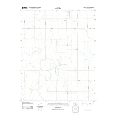
2012 Map of Sharon South
USGS Topo · Published 2012About this map
The town of Sharon, Kansas, serves as the northern anchor of this landscape, where the Main St corridor and a local Po reflect a quintessential rural community hub. The surrounding terrain is defined by the drainage basins of Salty Cr and Little Sandy Cr, which weave through a grid of section-line roads. This network of thoroughfares, including Cedar Hills Rd and Sandplum Rd, illustrates the persistent structural organization of Kansas farmland. Near the town center, the Sharon Cem stands as a primary point of interest for genealogists and local historians, while the intersection of Missouri St and SE Cardinal provides a clear view of the village's small-town geometry in the early twenty-first century.
Find a feature on this map
30 named features on this map. Tap any name to fly to it.
Don’t see what you’re looking for? This feature index may not catch every label — zoom into the map to look around manually.
Map Details
Editions of this 2012 Sharon South Map
This is the sole edition of this map. No revisions or reprints were ever made.
Other maps of this area

1889 · Anthony
USGS Topo · 1:125,000

1891 · Medicine Lodge
USGS Topo · 1:125,000

1891 · Anthony
USGS Topo · 1:125,000

1893 · Medicine Lodge
USGS Topo · 1:125,000

1955 · Pratt
USGS Topo · 1:250,000

1959 · Pratt
USGS Topo · 1:250,000

1972 · Sharon South
USGS Topo · 1:24,000
1972 · Kiowa
USGS Topo · 1:24,000
1972 · Corwin
USGS Topo · 1:24,000

1972 · Crisfield
USGS Topo · 1:24,000