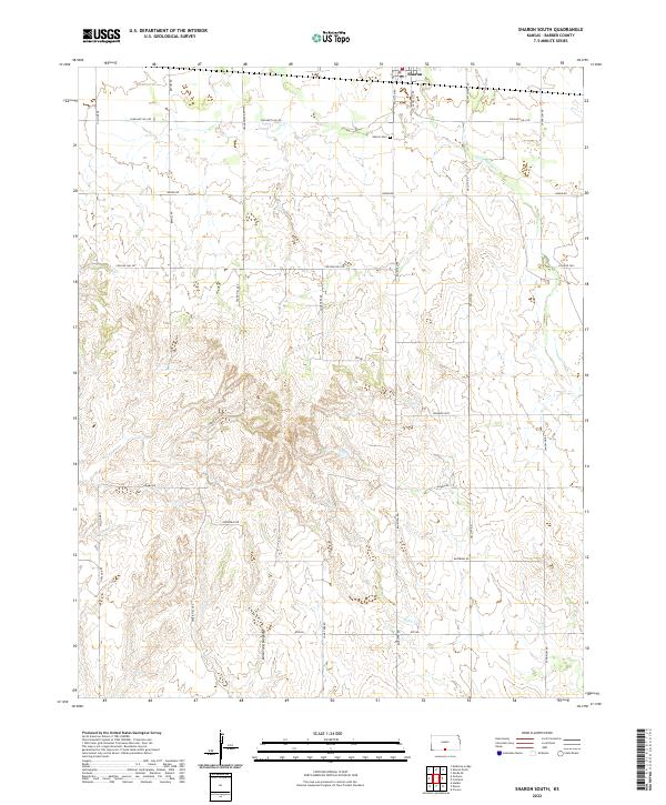
2022 Map of Sharon South
USGS Topo · Published 2022About this map
The southern portion of Sharon anchors this section of Barber County, where the agricultural grid meets the increasingly broken terrain of the southern Kansas plains. The landscape here is defined by a dense network of sectional roads and the headwaters of Little Sandy Cr, which drain the northern reaches before the topography drops away into the more complex draws of Lone Tree Canyon. This area illustrates a classic Great Plains settlement pattern, where named landmarks like Crooked Post and Sharon Cem serve as vital reference points across the vast stretches of ranch and farmland.
Find a feature on this map
26 named features on this map. Tap any name to fly to it.
Don’t see what you’re looking for? This feature index may not catch every label — zoom into the map to look around manually.
Map Details
Editions of this 2022 Sharon South Map
This is the sole edition of this map. No revisions or reprints were ever made.
Other maps of this area

1889 · Anthony
USGS Topo · 1:125,000

1891 · Medicine Lodge
USGS Topo · 1:125,000

1891 · Anthony
USGS Topo · 1:125,000

1893 · Medicine Lodge
USGS Topo · 1:125,000

1955 · Pratt
USGS Topo · 1:250,000

1959 · Pratt
USGS Topo · 1:250,000

1972 · Sharon South
USGS Topo · 1:24,000
1972 · Kiowa
USGS Topo · 1:24,000
1972 · Corwin
USGS Topo · 1:24,000

1972 · Crisfield
USGS Topo · 1:24,000