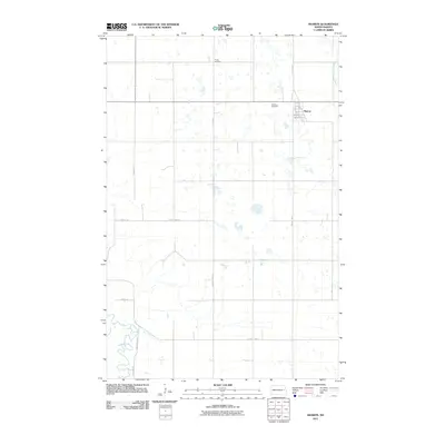
2011 Map of Sharon
USGS Topo · Published 2011About this map
The town of Sharon sits at the intersection of County Hwy-7 and state route St Co 25, serving as a focal point for the surrounding Steele County agricultural landscape. This 2011 survey illustrates the precise layout of the town, including its residential grid from 1st Ave E to 3rd St S. Genealogists will find the locations of Sharon Cemetery and Trinity Cemetery clearly marked, offering essential reference points for local family history research. The terrain is defined by its water systems, with the Middle Branch Goose River winding through the northeast while the Sheyenne River meanders along the southwestern boundary, crossing into Griggs County 23. This map captures the modern road network, including arterial routes like County Hwy-18 and 8th St NE, that connects these prairie settlements and natural waterways.
Find a feature on this map
17 named features on this map. Tap any name to fly to it.
Don’t see what you’re looking for? This feature index may not catch every label — zoom into the map to look around manually.
Map Details
Editions of this 2011 Sharon Map
This is the sole edition of this map. No revisions or reprints were ever made.
Other maps of this area

1952 · Grand Forks
USGS Topo · 1:250,000

1952 · New Rockford
USGS Topo · 1:250,000

1956 · New Rockford
USGS Topo · 1:250,000

1956 · Grand Forks
USGS Topo · 1:250,000

1961 · Cooperstown East
USGS Topo · 1:24,000

1966 · Grand Forks
USGS Topo · 1:250,000

1967 · Finley NE
USGS Topo · 1:24,000

1967 · Blabon
USGS Topo · 1:24,000
1967 · Kloten SE
USGS Topo · 1:24,000

1967 · Finley
USGS Topo · 1:24,000