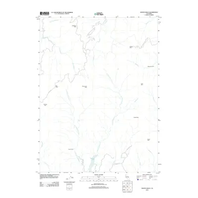
2012 Map of Shasta Bally
USGS Topo · Published 2012About this map
Whiskeytown-Shasta-Trinity NRA dominates the high-altitude landscape of this northern California terrain. The geography is defined by a series of prominent peaks known as ballies, including Buckhorn Bally, Shoemaker Bally, Little Bally, and the namesake Shasta Bally summit. These high points form a divide where numerous drainages originate, most notably the N Fork Cottonwood Cr and its tributaries like Moon Fork Cottonwood Cr. In the southern portion of the sheet, Rainbow Lake serves as a primary water feature, accessed by Rainbow Lake Rd. The map reveals a network of ridge roads and trails, such as Baker Ridge Rd and E Co Line Rd, which trace the difficult topography around Paradise Peak and Blue Ridge. This area shows the complex drainage patterns of the eastern Trinity Mountains, where steep gulches like Beartrap Gulch and Taylor Gulch feed into the larger creek systems.
Find a feature on this map
30 named features on this map. Tap any name to fly to it.
Don’t see what you’re looking for? This feature index may not catch every label — zoom into the map to look around manually.
Map Details
Editions of this 2012 Shasta Bally Map
This is the sole edition of this map. No revisions or reprints were ever made.
Other maps of this area

1890 · Red Bluff
USGS Topo · 1:250,000

1894 · Red Bluff
USGS Topo · 1:250,000

1913 · Weaverville
USGS Topo · 1:125,000

1944 · French Gulch
USGS Topo · 1:62,500

1948 · French Gulch
USGS Topo · 1:62,500

1950 · Weaverville
USGS Topo · 1:62,500

1951 · Chanchelulla Peak
USGS Topo · 1:62,500

1952 · Weaverville
USGS Topo · 1:62,500

1952 · Ono
USGS Topo · 1:62,500

1958 · Redding
USGS Topo · 1:250,000