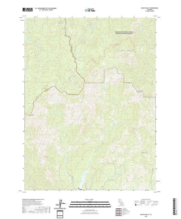
2022 Map of Shasta Bally
USGS Topo · Published 2022About this map
The Whiskeytown-Shasta-Trinity National Recreation Area dominates the northern reaches of this landscape, anchored by the high point of Shasta Bally. This area is characterized by a series of prominent peaks and "ballies" including Shoemaker Bally, Buckhorn Bally, and Little Bally, creating a divide between the drainages of Grass Valley Creek and the North Fork Cottonwood Creek. To the south, Rainbow Lake serves as a significant water feature near the junction of Rainbow Lake Road and Baker Ridge Road. The terrain is marked by a network of gulches and ridges, such as Taylor Gulch and Blue Ridge, with higher elevations accessed by historic routes like the Shasta Bally Trail and Queen Mary Trail. This 2022 survey details the remote, high-altitude boundary between Trinity and Shasta counties.
Find a feature on this map
39 named features on this map. Tap any name to fly to it.
Don’t see what you’re looking for? This feature index may not catch every label — zoom into the map to look around manually.
Map Details
Editions of this 2022 Shasta Bally Map
This is the sole edition of this map. No revisions or reprints were ever made.
Other maps of this area

1890 · Red Bluff
USGS Topo · 1:250,000

1894 · Red Bluff
USGS Topo · 1:250,000

1913 · Weaverville
USGS Topo · 1:125,000

1944 · French Gulch
USGS Topo · 1:62,500

1948 · French Gulch
USGS Topo · 1:62,500

1950 · Weaverville
USGS Topo · 1:62,500

1951 · Chanchelulla Peak
USGS Topo · 1:62,500

1952 · Weaverville
USGS Topo · 1:62,500

1952 · Ono
USGS Topo · 1:62,500

1958 · Redding
USGS Topo · 1:250,000