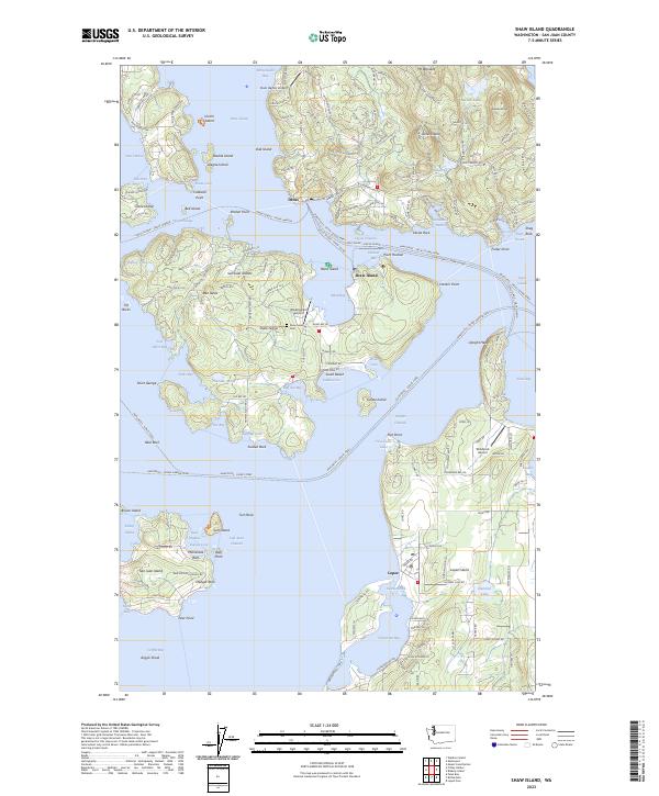
2023 Map of Shaw Island
USGS Topo · Published 2023About this map
San Juan Islands National Monument and the surrounding marine wilderness define this coastal landscape, which encompasses several major islands including Shaw Island and portions of Orcas and Lopez. The interior of Shaw Island is marked by a network of rural routes like Neck Point Rd and Rue Gilson, while the Shaw Island Cem serves as a central point for local history. Marine navigation is shaped by complex channels such as Cayou Channel and Wasp Passage, and the coastline is punctuated by features like Blind Island, Bell Island, and the peaks of Ben Nevis and Mt Woolard. On the eastern edge, Hummel Lake and the Windsock Airport sit near the settlement of Lopez, showing the continued integration of small-scale aviation into island life. This survey provides an exact record of the protected lands and small private holdings that characterize the San Juan archipelago in the early twenty-first century.
Find a feature on this map
178 named features on this map. Tap any name to fly to it.
Don’t see what you’re looking for? This feature index may not catch every label — zoom into the map to look around manually.
Map Details
Editions of this 2023 Shaw Island Map
This is the sole edition of this map. No revisions or reprints were ever made.
Other maps of this area

1943 · Richardson
USGS Topo · 1:62,500

1943 · Orcas Island
USGS Topo · 1:62,500

1954 · Waldron Island
USGS Topo · 1:24,000

1954 · Friday Harbor
USGS Topo · 1:24,000

1954 · False Bay
USGS Topo · 1:24,000

1957 · Richardson
USGS Topo · 1:62,500

1957 · Orcas Island
USGS Topo · 1:62,500

1957 · Victoria
USGS Topo · 1:250,000
1973 · Lopez Pass
USGS Topo · 1:24,000

1973 · Shaw Island
USGS Topo · 1:24,000