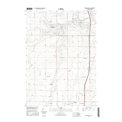
2016 Map of Sheboygan Falls
USGS Topo · Published 2016About this map
Sheboygan Falls and the surrounding dairy lands of Sheboygan County are defined by the winding course of the Sheboygan River and its tributaries. This landscape, as it appeared in 2016, reveals the industrial and agricultural heritage of the region, from the Sheboygan Falls Millpond to the smaller Kohler Mill Pond in Kohler. The density of rural burial grounds, such as Saint Marys Cem and Gibbsville Cem, provides a detailed record for genealogists tracing family roots in small communities like Gibbsville and Weedens. The hydrology of the area is particularly complex, with the Mullet River and Onion River converging toward the main stem of the Sheboygan, while the Black River and Weedons Creek drain the eastern lowlands toward Lake Michigan. This survey documents the modern layout of the Kohler estate and the expansion of residential roads like Woodlake Road and Highland Drive.
Find a feature on this map
134 named features on this map. Tap any name to fly to it.
Don’t see what you’re looking for? This feature index may not catch every label — zoom into the map to look around manually.
Map Details
Editions of this 2016 Sheboygan Falls Map
This is the sole edition of this map. No revisions or reprints were ever made.
Other maps of this area

1954 · Sheboygan Falls
USGS Topo · 1:62,500

1954 · Sheboygan South
USGS Topo · 1:62,500

1954 · Sheboygan Falls
USGS Topo · 1:24,000

1954 · Sheboygan North
USGS Topo · 1:62,500

1954 · Sheboygan North
USGS Topo · 1:24,000

1954 · Sheboygan South
USGS Topo · 1:24,000

1954 · Howards Grove
USGS Topo · 1:62,500

1954 · Howards Grove
USGS Topo · 1:24,000

1954 · Franklin
USGS Topo · 1:24,000

1954 · Milwaukee
USGS Topo · 1:250,000