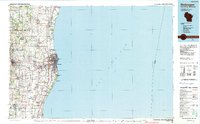
1989 Map of Sheboygan
USGS Topo · Published 1990About this map
The Lake Michigan coastline anchors this late-twentieth-century study of eastern Wisconsin, where the industrial and residential centers of Sheboygan and Kohler meet the waterfront. The landscape is defined by the winding paths of the Sheboygan River, Mullet River, and Onion River, which historically powered the development of communities like Sheboygan Falls and Plymouth. Beyond the urban centers, the map reveals a well-established network of smaller settlements such as Gibbsville, Hingham, and Oostburg, reflecting the region's agricultural and rural heritage.
Find a feature on this map
67 named features on this map. Tap any name to fly to it.
Don’t see what you’re looking for? This feature index may not catch every label — zoom into the map to look around manually.
Map Details
Editions of this 1989 Sheboygan Map
This is the sole edition of this map. No revisions or reprints were ever made.
Other maps of this area

1892 · Port Washington
USGS Topo · 1:62,500

1904 · West Bend
USGS Topo · 1:62,500

1904 · Port Washington
USGS Topo · 1:62,500

1954 · Sheboygan Falls
USGS Topo · 1:62,500

1954 · Sheboygan South
USGS Topo · 1:62,500

1954 · School Hill
USGS Topo · 1:24,000

1954 · Sheboygan Falls
USGS Topo · 1:24,000

1954 · Manitowoc
USGS Topo · 1:62,500

1954 · Cleveland
USGS Topo · 1:24,000

1954 · St. Wendel
USGS Topo · 1:24,000