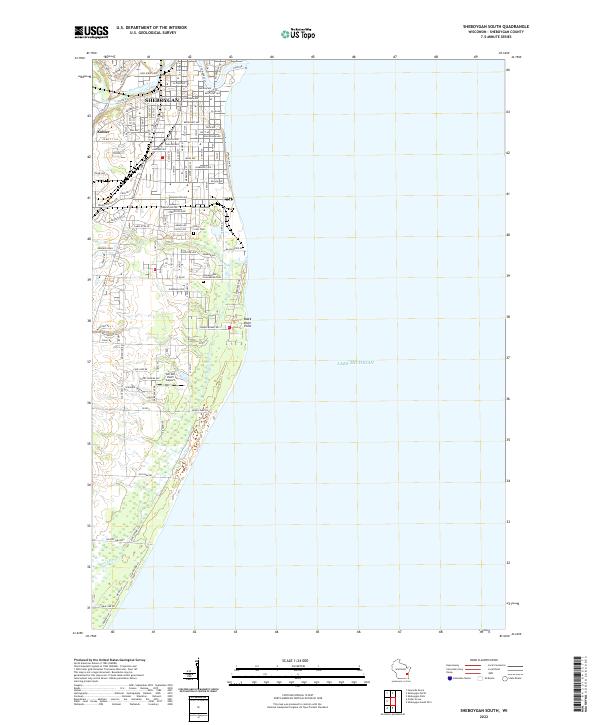
2022 Map of Sheboygan South
USGS Topo · Published 2022About this map
Sheboygan expands southward in this contemporary survey, showing a landscape defined by the long coastline of Lake Michigan. The urban street grid, with its state-named thoroughfares like Alabama Ave and Kentucky Ave, transitions into residential developments and the industrial character of Kohler along the Sheboygan River. Further south, the map reveals a more varied topography where the Black River meanders toward Black River Point. Notable landmarks for local history include Holy Cross Cem and Immaculate Conception Cem, situated near suburban clusters. The presence of Van Der Vaart Airport and arterial routes like Indian Mound Rd highlight the modern transportation network supporting this lakefront community. This record captures the delicate balance between the growing built environment and the natural shoreline features that shape the region's identity.
Find a feature on this map
99 named features on this map. Tap any name to fly to it.
Don’t see what you’re looking for? This feature index may not catch every label — zoom into the map to look around manually.
Map Details
Editions of this 2022 Sheboygan South Map
This is the sole edition of this map. No revisions or reprints were ever made.
Other maps of this area

1954 · Sheboygan Falls
USGS Topo · 1:62,500

1954 · Sheboygan South
USGS Topo · 1:62,500

1954 · Sheboygan Falls
USGS Topo · 1:24,000

1954 · Sheboygan North
USGS Topo · 1:62,500

1954 · Sheboygan North
USGS Topo · 1:24,000

1954 · Sheboygan South
USGS Topo · 1:24,000

1954 · Howards Grove
USGS Topo · 1:62,500

1954 · Howards Grove
USGS Topo · 1:24,000

1954 · Milwaukee
USGS Topo · 1:250,000

1958 · Milwaukee
USGS Topo · 1:250,000