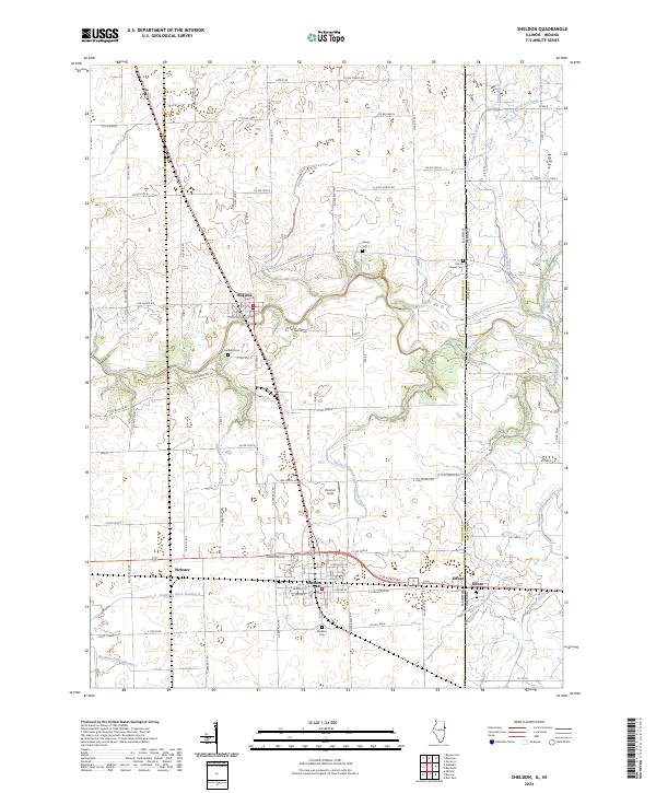
2024 Map of Sheldon
USGS Topo · Published 2024About this map
The Iroquois River meanders across the Illinois and Indiana border, anchoring a landscape defined by organized drainage and the village of Sheldon. This region reflects a deeply agrarian structure, where the extensive network of engineered waterways like Eastburn Ditch Number 2 and North Sheldon-South Concord Ditch has long managed the prairie wetlands for cultivation. Local genealogy is well-represented through several burial grounds including Gaffield Cem and Morris Chapel Cem, which sit alongside historic road alignments such as Co RD 2300 N. The settlement of Effner marks a distinct border point between Iroquois County and Newton County. Modern landmarks like Zoomer Field appear amidst the traditional township and range grid, showing how the rural utility of the land has evolved while maintaining its core agricultural identity.
Find a feature on this map
102 named features on this map. Tap any name to fly to it.
Don’t see what you’re looking for? This feature index may not catch every label — zoom into the map to look around manually.
Map Details
Editions of this 2024 Sheldon Map
This is the sole edition of this map. No revisions or reprints were ever made.
Other maps of this area

1935 · Watseka
USGS Topo · 1:48,000

1938 · Milford
USGS Topo · 1:48,000

1939 · Watseka
USGS Topo · 1:62,500

1944 · Milford
USGS Topo · 1:62,500

1953 · Danville
USGS Topo · 1:250,000

1955 · Danville
USGS Topo · 1:250,000

1956 · Danville
USGS Topo · 1:250,000

1961 · Kentland
USGS Topo · 1:24,000

1961 · Morocco
USGS Topo · 1:24,000

1962 · Earl Park
USGS Topo · 1:24,000