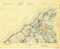
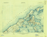
1904 Map of Shelter Island
USGS Topo · Published 1925About this map
Sag Harbor and the terminal hub of Greenport anchor this coastal landscape at the eastern end of Long Island. The map reveals a maritime economy defined by the Long Island Railroad and various steamboat routes connecting the North and South Forks with Shelter Island Sound. Notable Victorian-era landmarks include the Manhanset House and the early planned community of Shelter Island Heights.
Find a feature on this map
85 named features on this map. Tap any name to fly to it.
Don’t see what you’re looking for? This feature index may not catch every label — zoom into the map to look around manually.
Map Details
Editions of this 1904 Shelter Island Map
6 editions found
Other maps of this area

1903 · Sag Harbor
USGS Topo · 1:62,500

1903 · Gardiners Island
USGS Topo · 1:62,500

1903 · Riverhead
USGS Topo · 1:62,500

1904 · Sag Harbor
USGS Topo · 1:62,500

1904 · Shelter Island
USGS Topo · 1:62,500

1904 · Easthampton
USGS Topo · 1:62,500

1904 · Gardiners Island
USGS Topo · 1:62,500

1904 · Riverhead
USGS Topo · 1:62,500

1921 · Gardiners Island
USGS Topo · 1:62,500

1921 · Easthampton
USGS Topo · 1:62,500