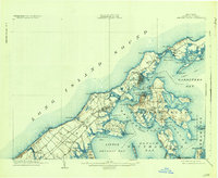
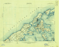
1904 Map of Shelter Island
USGS Topo · Published 1935About this map
Greenport and Sag Harbor anchor this early 20th-century maritime landscape, where the Long Island RR terminates at the shoreline to meet a busy network of water travel. The survey details the intricate geography of the North and South Forks, separated by the expansive Shelter Island Sound and Gardiners Bay. On Shelter Island, the settlement at Shelter Island Heights and the Manhanset House illustrate the era's established coastal residency.
Find a feature on this map
82 named features on this map. Tap any name to fly to it.
Don’t see what you’re looking for? This feature index may not catch every label — zoom into the map to look around manually.
Map Details
Editions of this 1904 Shelter Island Map
6 editions found
Other maps of this area

1903 · Sag Harbor
USGS Topo · 1:62,500

1903 · Gardiners Island
USGS Topo · 1:62,500

1903 · Riverhead
USGS Topo · 1:62,500

1904 · Sag Harbor
USGS Topo · 1:62,500

1904 · Shelter Island
USGS Topo · 1:62,500

1904 · Easthampton
USGS Topo · 1:62,500

1904 · Gardiners Island
USGS Topo · 1:62,500

1904 · Riverhead
USGS Topo · 1:62,500

1921 · Gardiners Island
USGS Topo · 1:62,500

1921 · Easthampton
USGS Topo · 1:62,500