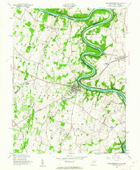
1953 Map of Shepherdstown
USGS Topo · Published 1961About this map
Shepherdstown serves as the focal point of this mid-century survey, situated at a dramatic meander where the Potomac River divides West Virginia from Maryland. The town's academic and civic character is evident through the campus of Shepherd College and the local High School, while its connection across the water is maintained by the James Rumsey Bridge. Along the Maryland shore, the historical infrastructure of the Chesapeake and Ohio Canal parallels the river, passing near landmarks like Millers Sawmill and the settlement of Sharpsburg.
Find a feature on this map
38 named features on this map. Tap any name to fly to it.
Don’t see what you’re looking for? This feature index may not catch every label — zoom into the map to look around manually.
Map Details
Editions of this 1953 Shepherdstown Map
4 editions found
Other maps of this area

1884 · Harpers Ferry
USGS Topo · 1:125,000

1891 · Harpers Ferry
USGS Topo · 1:125,000

1893 · Harpers Ferry
USGS Topo · 1:125,000

1908 · Middletown
USGS Topo · 1:48,000

1909 · Hagerstown
USGS Topo · 1:48,000

1910 · Antietam
USGS Topo · 1:62,500

1912 · Hagerstown
USGS Topo · 1:62,500

1912 · Williamsport
USGS Topo · 1:62,500

1914 · Martinsburg
USGS Topo · 1:48,000

1916 · Martinsburg
USGS Topo · 1:62,500