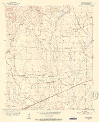
1951 Map of Sheppard
USGS Topo · Published 1952About this map
Guernsey sits at a critical junction of the mid-century Arkansas rail network, where the Missouri Pacific and St Louis San Francisco lines converge. This rural landscape in the early 1950s is defined by a dense network of family-named landmarks and community institutions, including Guernsey High Sch and the nearby Guernsey Sch. The area's spiritual and civic life is anchored by numerous small congregations such as St Luke Ch, Mt Sinai Ch, and New Hope Ch.
Find a feature on this map
43 named features on this map. Tap any name to fly to it.
Don’t see what you’re looking for? This feature index may not catch every label — zoom into the map to look around manually.
Map Details
Editions of this 1951 Sheppard Map
4 editions found
Other maps of this area

1951 · Blevins
USGS Topo · 1:24,000

1951 · Patmos
USGS Topo · 1:24,000

1951 · Fulton
USGS Topo · 1:24,000

1951 · Columbus
USGS Topo · 1:24,000

1951 · Sheppard
USGS Topo · 1:24,000

1951 · Spring Hill
USGS Topo · 1:24,000

1951 · Washington
USGS Topo · 1:24,000

1951 · Hope
USGS Topo · 1:24,000

1951 · Mc Nab
USGS Topo · 1:24,000

1953 · El Dorado
USGS Topo · 1:250,000