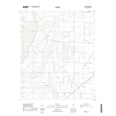
2018 Map of Sherard
USGS Topo · Published 2018About this map
Sherard and Bobo anchor this Coahoma County landscape, where the flat alluvial plains of the Mississippi Delta are defined by a complex network of wetlands and drainage. The territory is marked by slow-moving water bodies like Harris Bayou, Richies Bayou, and the expansive Lewis Swamp, reflecting the region's historic hydrology before modern engineering fully transformed the basin. Local genealogical interest is found at Nathan Cem and Dogwood Cem, small land-tied landmarks that speak to the long-standing agricultural communities of the area. A sprawling grid of rural roads, including Sherard Rd and Bobo - New Africa Rd, connects the scattered settlements and farmsteads. Elevated terrain is scarce, with Annis Ridge providing a subtle rise above the surrounding sloughs and bayous, illustrating the delicate relationship between settlement patterns and the delta’s flood-prone geography.
Find a feature on this map
45 named features on this map. Tap any name to fly to it.
Don’t see what you’re looking for? This feature index may not catch every label — zoom into the map to look around manually.
Map Details
Editions of this 2018 Sherard Map
This is the sole edition of this map. No revisions or reprints were ever made.
Other maps of this area

1908 · Coahoma
USGS Topo · 1:24,000

1910 · Coahoma
USGS Topo · 1:31,680

1930 · Mellwood
USGS Topo · 1:62,500

1935 · Clarksdale
USGS Topo · 1:62,500

1939 · Farrell
USGS Topo · 1:62,500

1939 · Modoc
USGS Topo · 1:62,500

1939 · Clarksdale
USGS Topo · 1:62,500

1939 · Mellwood
USGS Topo · 1:62,500

1948 · Helena
USGS Topo · 1:250,000

1948 · Modoc
USGS Topo · 1:62,500