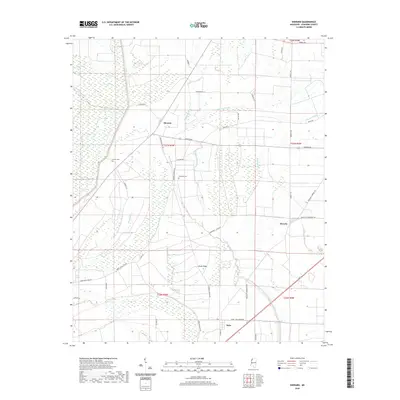
2020 Map of Sherard
USGS Topo · Published 2020About this map
Sherard and Bobo anchor this portion of the Mississippi Delta, where the landscape is defined by an intricate network of waterways and low-lying swampland. The terrain is dominated by the meandering paths of Harris Bayou, Dogwood Bayou, and Black Bayou, which drain into larger features like Ward Lake and Lewis Swamp. This 2020 survey illustrates how the local geography continues to revolve around these drainage patterns, with roads like Bobo Sherard Rd and Sherard Rd following the slightly higher ground of the alluvial plain.
Find a feature on this map
44 named features on this map. Tap any name to fly to it.
Don’t see what you’re looking for? This feature index may not catch every label — zoom into the map to look around manually.
Map Details
Editions of this 2020 Sherard Map
This is the sole edition of this map. No revisions or reprints were ever made.
Other maps of this area

1908 · Coahoma
USGS Topo · 1:24,000

1910 · Coahoma
USGS Topo · 1:31,680

1930 · Mellwood
USGS Topo · 1:62,500

1935 · Clarksdale
USGS Topo · 1:62,500

1939 · Farrell
USGS Topo · 1:62,500

1939 · Modoc
USGS Topo · 1:62,500

1939 · Clarksdale
USGS Topo · 1:62,500

1939 · Mellwood
USGS Topo · 1:62,500

1948 · Helena
USGS Topo · 1:250,000

1948 · Modoc
USGS Topo · 1:62,500