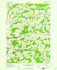
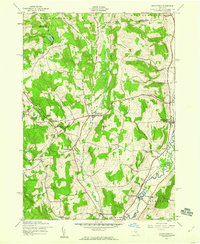
1943 Map of Sherburne
USGS Topo · Published 1960About this map
Sherburne and the surrounding township appear during the mid-war period when the Chenango River valley supported a dense network of rural schoolhouses and family cemeteries. The landscape is defined by its deep valleys and significant elevations, including Hunts Mountain and Sugarloaf Mountain, which separate the agricultural lowlands from the high ridges of Hamilton and Brookfield. Local history is anchored by established community sites such as Harrisville and the Negro Hollow Ch, alongside numerous numbered districts like School No 13 and School No 1. The map documents a traditional dairy and timber landscape just before post-war modernization, tracing waterways like Handsome Brook and West Brook as they feed the primary river system. This survey provides a precise account of property placement and civil infrastructure, including several family burial grounds like the Tillotson Cem and Palmer Cem.
Find a feature on this map
37 named features on this map. Tap any name to fly to it.
Don’t see what you’re looking for? This feature index may not catch every label — zoom into the map to look around manually.
Map Details
Editions of this 1943 Sherburne Map
4 editions found
Other maps of this area

1902 · Morrisville
USGS Topo · 1:62,500

1903 · Norwich
USGS Topo · 1:62,500

1907 · Sangerfield
USGS Topo · 1:62,500

1910 · New Berlin
USGS Topo · 1:62,500

1912 · New Berlin
USGS Topo · 1:62,500

1943 · New Berlin North
USGS Topo · 1:24,000

1943 · New Berlin South
USGS Topo · 1:24,000

1943 · Hubbardsville
USGS Topo · 1:24,000

1943 · Sangerfield
USGS Topo · 1:62,500
1943 · Brookfield
USGS Topo · 1:24,000