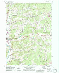
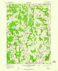
1943 Map of Sherburne
USGS Topo · Published 1994About this map
The Chenango River valley serves as the central artery for this mid-century survey of Chenango County, where the village of Sherburne is established as a regional hub at the intersection of river and rail. The town's layout reflects a classic upstate development pattern, with the Sherburne-Earlville High Sch and multiple burial grounds like Rexford Falls Cem anchoring the community. To the east, the landscape transitions into the uplands of Columbus Hill and Hunts Mountain, marked by smaller agricultural settlements and a network of rural cemeteries including Tillotson Cem and Campbell Cem.
Find a feature on this map
35 named features on this map. Tap any name to fly to it.
Don’t see what you’re looking for? This feature index may not catch every label — zoom into the map to look around manually.
Map Details
Editions of this 1943 Sherburne Map
4 editions found
Other maps of this area

1902 · Morrisville
USGS Topo · 1:62,500

1903 · Norwich
USGS Topo · 1:62,500

1907 · Sangerfield
USGS Topo · 1:62,500

1910 · New Berlin
USGS Topo · 1:62,500

1912 · New Berlin
USGS Topo · 1:62,500

1943 · New Berlin North
USGS Topo · 1:24,000

1943 · New Berlin South
USGS Topo · 1:24,000

1943 · Hubbardsville
USGS Topo · 1:24,000

1943 · Sangerfield
USGS Topo · 1:62,500
1943 · Brookfield
USGS Topo · 1:24,000