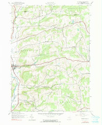
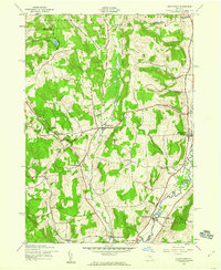
1943 Map of Sherburne
USGS Topo · Published 1991About this map
The Chenango River valley and its surrounding uplands define this area of Central New York during the early 1940s. The village of Sherburne serves as the primary center of activity, situated along the valley floor near the old Canal and Mad Brook. The surrounding landscape is characterized by a high density of rural schoolhouses and family cemeteries, reflecting an era before the wide-scale consolidation of district schools. Researchers can find School No 12, School No 13, and School No 15 scattered across the hills, along with family burial grounds such as Palmer Cem and Tillotson Cem. Notable terrain features include Hunts Mountain and Sugarloaf Mountain, which overlook the distinct valley of Negro Hollow and its eponymous Negro Hollow Ch, providing a detailed view of the township's layout during this period of agrarian stability.
Find a feature on this map
39 named features on this map. Tap any name to fly to it.
Don’t see what you’re looking for? This feature index may not catch every label — zoom into the map to look around manually.
Map Details
Editions of this 1943 Sherburne Map
4 editions found
Other maps of this area

1902 · Morrisville
USGS Topo · 1:62,500

1903 · Norwich
USGS Topo · 1:62,500

1907 · Sangerfield
USGS Topo · 1:62,500

1910 · New Berlin
USGS Topo · 1:62,500

1912 · New Berlin
USGS Topo · 1:62,500

1943 · New Berlin North
USGS Topo · 1:24,000

1943 · New Berlin South
USGS Topo · 1:24,000

1943 · Hubbardsville
USGS Topo · 1:24,000

1943 · Sangerfield
USGS Topo · 1:62,500
1943 · Brookfield
USGS Topo · 1:24,000