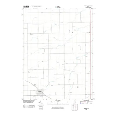
2010 Map of Sheridan
USGS Topo · Published 2010About this map
The town of Sheridan anchors the southwestern portion of this landscape, showing its residential blocks and central district just north of the Crown Hill Cemetery. The surrounding countryside is defined by a dense grid of rural roads and the winding paths of Cicero Creek, Prairie Creek, and Little Cicero Creek. These waterways dictate much of the local topography, punctuated by small unincorporated settlements such as Boxley, Ekin, and Bakers Corner.
Find a feature on this map
64 named features on this map. Tap any name to fly to it.
Don’t see what you’re looking for? This feature index may not catch every label — zoom into the map to look around manually.
Map Details
Editions of this 2010 Sheridan Map
This is the sole edition of this map. No revisions or reprints were ever made.
Other maps of this area

1953 · Westfield
USGS Topo · 1:24,000

1953 · Rosston
USGS Topo · 1:24,000

1953 · Noblesville
USGS Topo · 1:24,000

1953 · Danville
USGS Topo · 1:250,000

1955 · Danville
USGS Topo · 1:250,000

1956 · Danville
USGS Topo · 1:250,000

1960 · Noblesville
USGS Topo · 1:24,000

1960 · Kempton
USGS Topo · 1:24,000

1960 · Tipton
USGS Topo · 1:24,000

1961 · Sheridan
USGS Topo · 1:24,000