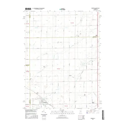
2016 Map of Sheridan
USGS Topo · Published 2016About this map
The town of Sheridan anchors the southern portion of this landscape where Boone and Hamilton counties meet. The area is defined by a dense network of agricultural drainage channels, including McKinzie Ditch, Little Cicero Cr, and Kigin Ditch, which manage the water levels of this fertile central Indiana plain. Small rural settlements like Boxley and Ekin remain distinct points on the map, often located near longstanding community landmarks. Genealogists will find several family and church burial grounds throughout the countryside, such as Spicewood Cem, Wiles Cem, and the larger Crown Hill Cem near the Sheridan town limits. The presence of both Sheridan Airport and Windy Knoll Airport suggests a modern rural landscape that maintains its traditional farming character while supporting local aviation infrastructure.
Find a feature on this map
75 named features on this map. Tap any name to fly to it.
Don’t see what you’re looking for? This feature index may not catch every label — zoom into the map to look around manually.
Map Details
Editions of this 2016 Sheridan Map
This is the sole edition of this map. No revisions or reprints were ever made.
Other maps of this area

1953 · Westfield
USGS Topo · 1:24,000

1953 · Rosston
USGS Topo · 1:24,000

1953 · Noblesville
USGS Topo · 1:24,000

1953 · Danville
USGS Topo · 1:250,000

1955 · Danville
USGS Topo · 1:250,000

1956 · Danville
USGS Topo · 1:250,000

1960 · Noblesville
USGS Topo · 1:24,000

1960 · Kempton
USGS Topo · 1:24,000

1960 · Tipton
USGS Topo · 1:24,000

1961 · Sheridan
USGS Topo · 1:24,000