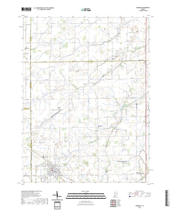
2022 Map of Sheridan
USGS Topo · Published 2022About this map
Sheridan anchors the southern landscape of this 2022 survey, surrounded by the agricultural heartland where Hamilton, Tipton, Clinton, and Boone counties converge. The town is flanked by municipal and private airfields, including Sheridan Airport and Windy Knoll Airport, while smaller crossroads like Boxley, Bakers Corner, and Ekin dot the surrounding township lines. This modern topographical study illustrates a region defined by an extensive network of drainage ditches and creeks, such as Little Cicero Cr and McKinzie Ditch, which manage the water levels of the central Indiana plains. Local history and genealogy are well-preserved through numerous small burial grounds including Hill's Baptist Cem, Ridge Cem, and Wiles Cem. These sites, along with landmarks like Crown View Cem near the town center, provide a precise record of the communities that have farmed these lands for generations.
Find a feature on this map
83 named features on this map. Tap any name to fly to it.
Don’t see what you’re looking for? This feature index may not catch every label — zoom into the map to look around manually.
Map Details
Editions of this 2022 Sheridan Map
This is the sole edition of this map. No revisions or reprints were ever made.
Other maps of this area

1953 · Westfield
USGS Topo · 1:24,000

1953 · Rosston
USGS Topo · 1:24,000

1953 · Noblesville
USGS Topo · 1:24,000

1953 · Danville
USGS Topo · 1:250,000

1955 · Danville
USGS Topo · 1:250,000

1956 · Danville
USGS Topo · 1:250,000

1960 · Noblesville
USGS Topo · 1:24,000

1960 · Kempton
USGS Topo · 1:24,000

1960 · Tipton
USGS Topo · 1:24,000

1961 · Sheridan
USGS Topo · 1:24,000