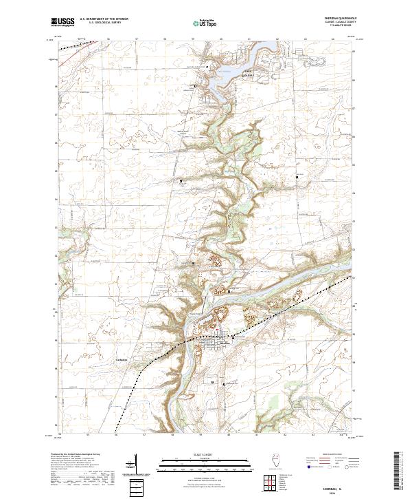
2024 Map of Sheridan
USGS Topo · Published 2024About this map
Sheridan sits at the heart of this LaSalle County landscape, where the confluence of Somonauk Creek and the Fox River shapes the local topography. This 2024 survey captures a rural landscape transitioning into recreational and residential use, most notably seen at Lake Holiday in the north. The area is dense with genealogical interest, containing a high concentration of established burial grounds including Sheridan Cem, Saint John Catholic Cem, and the Northville Cem. While much of the land remains organized by a strict section-line road grid, the winding paths of Mission Creek and Roods Creek provide natural breaks in the geometric fields. Aviation sites like Walnut Creek Airport and Cwian Field point to the modern character of the county, even as the small settlement of Catharine maintains its place on the map.
Find a feature on this map
81 named features on this map. Tap any name to fly to it.
Don’t see what you’re looking for? This feature index may not catch every label — zoom into the map to look around manually.
Map Details
Editions of this 2024 Sheridan Map
This is the sole edition of this map. No revisions or reprints were ever made.
Other maps of this area

1892 · Marseilles
USGS Topo · 1:62,500

1892 · Ottawa
USGS Topo · 1:62,500

1915 · Ottawa
USGS Topo · 1:62,500

1916 · Marseilles
USGS Topo · 1:62,500

1940 · Marseilles
USGS Topo · 1:62,500

1946 · Ottawa
USGS Topo · 1:62,500

1948 · Sandwich
USGS Topo · 1:62,500

1950 · Sandwich
USGS Topo · 1:62,500

1951 · Earlville
USGS Topo · 1:62,500

1958 · Aurora
USGS Topo · 1:250,000