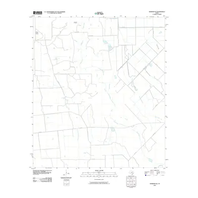
2010 Map of Sheridan SE
USGS Topo · Published 2010About this map
Brownson Cemetery and the northern reaches of the Sandy Creek drainage define this rural landscape in Colorado County. The terrain is a complex network of seasonal watercourses and local ranch roads, including the Lost Fork Goldenrod Creek and several branches of Turkey Creek. Transportation and commerce are centered on the private Galaxy Ranch Airport and the intersection of FM 333 Rd and Sandy Creek Rd.
Find a feature on this map
20 named features on this map. Tap any name to fly to it.
Don’t see what you’re looking for? This feature index may not catch every label — zoom into the map to look around manually.
Map Details
Editions of this 2010 Sheridan SE Map
This is the sole edition of this map. No revisions or reprints were ever made.
Other maps of this area

1953 · Seguin
USGS Topo · 1:250,000

1958 · Seguin
USGS Topo · 1:250,000

1959 · Garwood
USGS Topo · 1:24,000

1964 · Cordele
USGS Topo · 1:24,000

1964 · Speaks
USGS Topo · 1:24,000
1965 · Sheridan NE
USGS Topo · 1:24,000

1965 · Ganado NE
USGS Topo · 1:24,000

1965 · Sheridan SE
USGS Topo · 1:24,000

1965 · Gobbler Creek
USGS Topo · 1:24,000
1965 · Sheridan
USGS Topo · 1:24,000