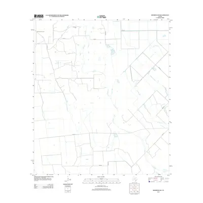
2013 Map of Sheridan SE
USGS Topo · Published 2013About this map
Brownson Cem sits near the northern edge of this Colorado County landscape, marking a quiet point of local history amidst a web of rural roads and drainage ways. The terrain is defined by a dense network of seasonal and perennial waterways, including the winding Sandy Cr and the distinctively named Lost Fork Goldenrod Cr. These streams dictate the layout of the local infrastructure, with county roads like Co RD 19 and Co RD 255 navigating the gaps between creek beds.
Find a feature on this map
19 named features on this map. Tap any name to fly to it.
Don’t see what you’re looking for? This feature index may not catch every label — zoom into the map to look around manually.
Map Details
Editions of this 2013 Sheridan SE Map
This is the sole edition of this map. No revisions or reprints were ever made.
Other maps of this area

1953 · Seguin
USGS Topo · 1:250,000

1958 · Seguin
USGS Topo · 1:250,000

1959 · Garwood
USGS Topo · 1:24,000

1964 · Cordele
USGS Topo · 1:24,000

1964 · Speaks
USGS Topo · 1:24,000
1965 · Sheridan NE
USGS Topo · 1:24,000

1965 · Ganado NE
USGS Topo · 1:24,000

1965 · Sheridan SE
USGS Topo · 1:24,000

1965 · Gobbler Creek
USGS Topo · 1:24,000
1965 · Sheridan
USGS Topo · 1:24,000