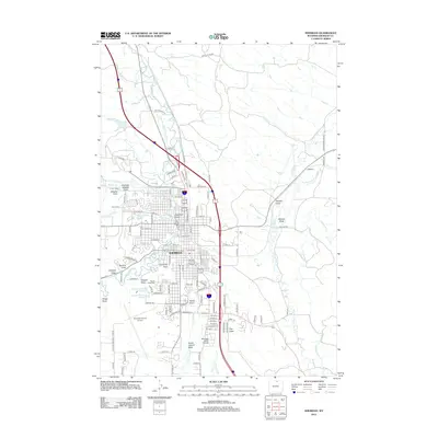
2012 Map of Sheridan
USGS Topo · Published 2012About this map
Sheridan is the central hub of this 2012 landscape, where the confluence of Goose Cr and Little Goose Cr defines the valley floor. The map documents the city's modern footprint, extending from the residential developments of Sheridan Heights Draw in the northwest to the academic grounds of Sheridan Junior College in the south. Aviation and transit infrastructure are prominent, with the Sheridan County Airport anchoring the western edge near Chapek Reservoir Number 1.
Find a feature on this map
111 named features on this map. Tap any name to fly to it.
Don’t see what you’re looking for? This feature index may not catch every label — zoom into the map to look around manually.
Map Details
Editions of this 2012 Sheridan Map
This is the sole edition of this map. No revisions or reprints were ever made.
Other maps of this area

1895 · Dayton
USGS Topo · 1:125,000

1901 · Dayton
USGS Topo · 1:125,000

1909 · Sheridan
USGS Topo · 1:125,000

1911 · Sheridan
USGS Topo · 1:125,000

1955 · Sheridan
USGS Topo · 1:250,000

1958 · Sheridan
USGS Topo · 1:250,000

1962 · Sheridan
USGS Topo · 1:250,000
1964 · Monarch
USGS Topo · 1:24,000
1964 · Hultz Draw
USGS Topo · 1:24,000
1964 · Beaver Creek Hills
USGS Topo · 1:24,000