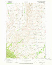
1964 Map of Beaver Creek Hills
USGS Topo · Published 1968About this map
Bighorn National Forest dominates the southwestern corner of this Sheridan County landscape, where the terrain transitions into the high Beaver Creek Hills. A distinct network of water management is visible through the Last Chance Ditch and several unnamed canals that lace the foothills, supporting the ranching and agricultural operations of the mid-1960s. The presence of a Polo Field and Landing Strip near Hanna Creek suggests a specific cultural and recreational history tied to the land use in this era.
Find a feature on this map
45 named features on this map. Tap any name to fly to it.
Don’t see what you’re looking for? This feature index may not catch every label — zoom into the map to look around manually.
Map Details
Editions of this 1964 Beaver Creek Hills Map
3 editions found
Other maps of this area

1895 · Dayton
USGS Topo · 1:125,000

1901 · Dayton
USGS Topo · 1:125,000

1909 · Sheridan
USGS Topo · 1:125,000

1911 · Sheridan
USGS Topo · 1:125,000

1955 · Sheridan
USGS Topo · 1:250,000

1958 · Sheridan
USGS Topo · 1:250,000

1962 · Sheridan
USGS Topo · 1:250,000

1964 · Wolf
USGS Topo · 1:24,000

1964 · Beckton
USGS Topo · 1:24,000
1964 · Hultz Draw
USGS Topo · 1:24,000