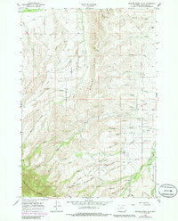
1964 Map of Beaver Creek Hills
USGS Topo · Published 1985About this map
Bighorn National Forest dominates the southwestern portion of this landscape, where the rising terrain of the Beaver Creek Hills meets the high country. A network of complex drainages including Big Goose Creek and Little Goose Creek flow through the region, shaped by an extensive system of irrigation ditches and pipelines that speak to the managed water economy of Sheridan County. The presence of the Red Grade Road providing access to the forest highlands is a primary landmark for local navigation and history.
Find a feature on this map
50 named features on this map. Tap any name to fly to it.
Don’t see what you’re looking for? This feature index may not catch every label — zoom into the map to look around manually.
Map Details
Editions of this 1964 Beaver Creek Hills Map
3 editions found
Other maps of this area

1895 · Dayton
USGS Topo · 1:125,000

1901 · Dayton
USGS Topo · 1:125,000

1909 · Sheridan
USGS Topo · 1:125,000

1911 · Sheridan
USGS Topo · 1:125,000

1955 · Sheridan
USGS Topo · 1:250,000

1958 · Sheridan
USGS Topo · 1:250,000

1962 · Sheridan
USGS Topo · 1:250,000

1964 · Wolf
USGS Topo · 1:24,000

1964 · Beckton
USGS Topo · 1:24,000
1964 · Hultz Draw
USGS Topo · 1:24,000